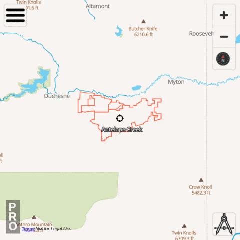
i-Hunting app includes Dwr Hunt Boundaries Combined hunt layer under Utah -> Dwr Hunt Boundaries Combined. To enable this layer, please use the following taps:
|
|
Available Attributes for Dwr Hunt Boundaries Combined , Utah
- Name
- Status
Available Dwr Hunt Boundaries Combined
- Allen Ranch
- Allen Ranch
- Alton
- Alton
- Antelope Creek
- Antelope Creek
- Antelope Creek
- Avintaquin Canyon
- Avintaquin Canyon
- Bally Watts
- Bar J Ranch
- Bar J Ranch
- Bear Mountain
- Bear Springs
- Beaver Hollow
- Blackhawk
- Blackhawk
- Black Point
- Blind Spring
- Bluebell
- Blue Creek
- Blue Spring Hills
- Boobe Hole
- Bootjack
- Broadmouth
- Buckhorn Ranch
- Castle Valley Outdoors
- Castle Valley Outdoors
- Causey Spring
- Cedar Canyon
- Cedar Springs
- Chimney Rock
- Chrises Creek
- Clear Valley Ranch
- Coldwater Ranch
- Coldwater Ranch
- Conover-Jensen
- Cotton Junction
- Cotton Thomas
- Cotton Thomas
- Cottonwood Ridge
- Cottonwood Ridge
- Coyote Little Pole
- Coyote Little Pole
- Crab Creek
- Curlew Valley Farms
- Deer Creek
- Deer Creek
- Deer Haven
- Deer Haven
- Deseret
- Deseret
- Deseret
- Deseret
- Dilly Ranch
- Double Cone
- Double Cone
- Double R Ranch
- Dove Creek
- Durst Mountain
- East Fork Chalk Creek
- East Zion
- East Zion
- Emma Park
- Emma Park
- Engineer Springs
- Ensign Ranches
- Folley Ridge
- Fort Ranch
- Fort Ranch
- George Creek
- Golden Spike
- Grass Valley/Clark Canyon
- Grass Valley/Clark Canyon
- Grazing Pasture
- Green Canyon
- Guildersleeve
- Guildersleeve
- Hardscrabble
- Hardscrabble
- Heartland West
- Heartland West
- Heaston East
- Heaston East
- Hell Canyon
- Hell Canyon
- Hiawatha
- Indian Creek
- Indian Head
- Ingham Peak
- Jacob's Creek
- J. B. Ranch
- Johnson Mtn Ranch
- Johnson Mtn Ranch
- Jump Creek
- Junction Valley
- Junction Valley
- Lazy H Ranch
- Lazy H Ranch
- Little Red Creek
- Lone Tree Taylor Hollow
- Mecham Ridge
- Middle Ridge
- Minnie Maud Ridge
- Missouri Flat
- Moon Ranch
- Moon Ranch
- Moon's Ranch
- Mountain Meadow
- Mountain Top
- Mt Carmel
- Neil Creek
- New Harmony
- North Peaks
- North Promontory
- Nucor West
- Oak Ranch
- Old Woman Plateau
- Pahvant Ensign
- Park Valley
- Park Valley
- Park Valley Hereford
- Park Valley Hereford
- Patmos Ridge
- Patmos Ridge
- Pine Canyon
- Pine Canyon
- Plymouth Peak
- Pocatello Valley
- Powder Mountain
- Preston Nutter Ranch
- Preston Nutter Ranch
- Promontory Point
- Rabbit Creek
- Rattlesnake Pass
- Rattlesnake Pass
- Redd Ranches
- Riverview Ranch LLC
- Riverview Ranch LLC
- RLF Deep Creek
- Roan Cliffs
- Rock House
- Round Valley
- Royal Ivory Outfitters
- Sage Valley Outfitters
- Sand Creek
- Sardine Canyon
- Scofield Canyons
- Scofield Canyons
- Scofield East
- Scofield East
- Scofield West
- Sharp Mountain
- SJ Ranch
- Skull Crack
- Skull Valley South
- Snowville Flat
- Soldier Summit
- Soldier Summit
- South Canyon
- South Canyon
- Spring Creek Acres
- Spring Creek/Dodge
- Spring Creek/Dodge
- Spring Creek/Dodge
- State Corner
- Stillman Creek Ranch
- Strawberry Ridge
- Summit Point
- Summit Point
- Thatcher Mountain
- The Rose of Snowville
- The Rose Of Snowville
- Three C
- TJ Cattle Company
- TJ Cattle Company
- TL Bar Ranch
- Twin Peaks - Goose Creek
- Twin Peaks/Goose Creek
- Two Bear
- Wallsburg
- Washakie
- Washakie
- Weber Florence Creek
- West Hills
- West Hills
- Westlake
- West Willow Creek Ranch
- White's Valley
- White's Valley
- Wood Canyon
- Wood Canyon
- Woodruff Creek South
- Woodruff Creek South
- Zane

